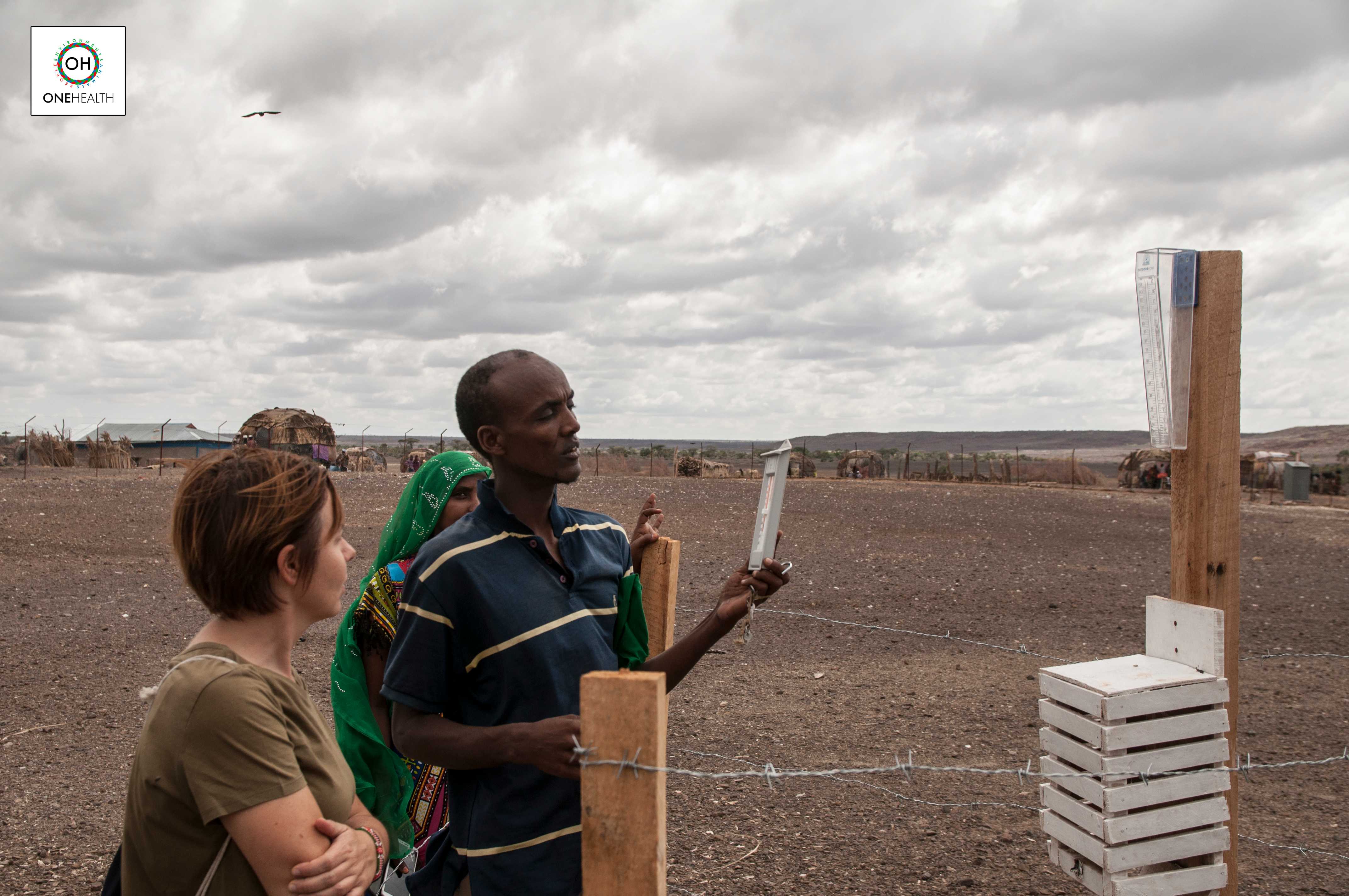
A Community based Weather Monitoring Network in North Horr Kenya
May 6th, 2020
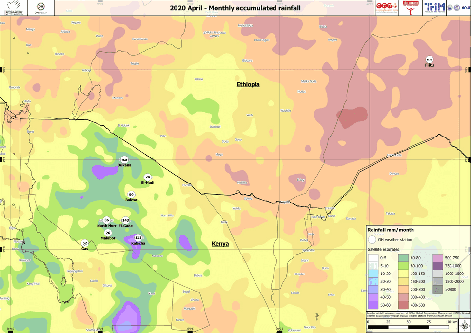
PLEASE FIND BELOW MAPS of Monthly Accumulated Rainfall 🌧️ calculated using NASA GPM satellite 🛰️ overlaid to the data measured by community members using One Health Manual Weather Stations 🌡️ in North Horr (Kenya) and Filtu (Ethiopia).
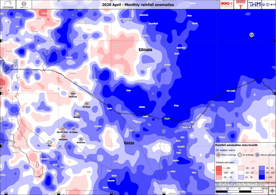
Absolute rainfall anomaly calculated using GPM data shows:
- CLOSE TO AVERAGE rainfall around North Horr, Malabot, Kalacha, Gas, El-Hadi,
- ⬇️SLIGHTLY BELOW AVERAGE around Dukana,
- ⬆️SLIGHTLY ABOVE AVERAGE around Balesa, El Gade and
- ⬆️⬆️ABOVE AVERAGE rainfall around Filtu.
Anomalies calculated using rain gauges installed at health facility level, are quite consistent with GPM satellite data for Gas, El Gade and North Horr, while Kalacha received about 50mm more than average and Balesa received slightly less than the average. The overlay of the two type of data 📊 shows the importance of integrating satellite information 🛰️ with ground based weather measurements 🌦️🏘️📈, to increase accuracy and usability of rainfall information at community level.
This analysis is produced in the framework of the One Health project: Multidisciplinary approach to promote the health and resilience of pastoralist in North Kenya – AID11507. It is a 3-year initiative funded by the Italian Agency for Development Cooperation, aimed at improving the access and coordination of human and animal health services and of early warning and response systems to dangerous events that could put the pastoralist communities' health in North Horr Sub-County at risk. The project is led by CCM-Comitato Collaborazione Medica in partnership with VSF Germany - Veterinarians without Borders Germany, TriM - Translate into Meaning, and DIST - Interuniversity Department of Regional and Urban Studies and Planning.

