Multi-Hazard Assessment in Marsabit (Kenya) May 2020
May 29th, 2020
Supporting the National Drought Management Authority (NDMA) in data collection and mapping
In the framework of the One Health project we had the opportunity of supporting the NDMA of Marsabit County, during their Multi-Hazard Assessment, in:
- Desert locust data collection
- Livestock diseases data collection
- Hazard maps production
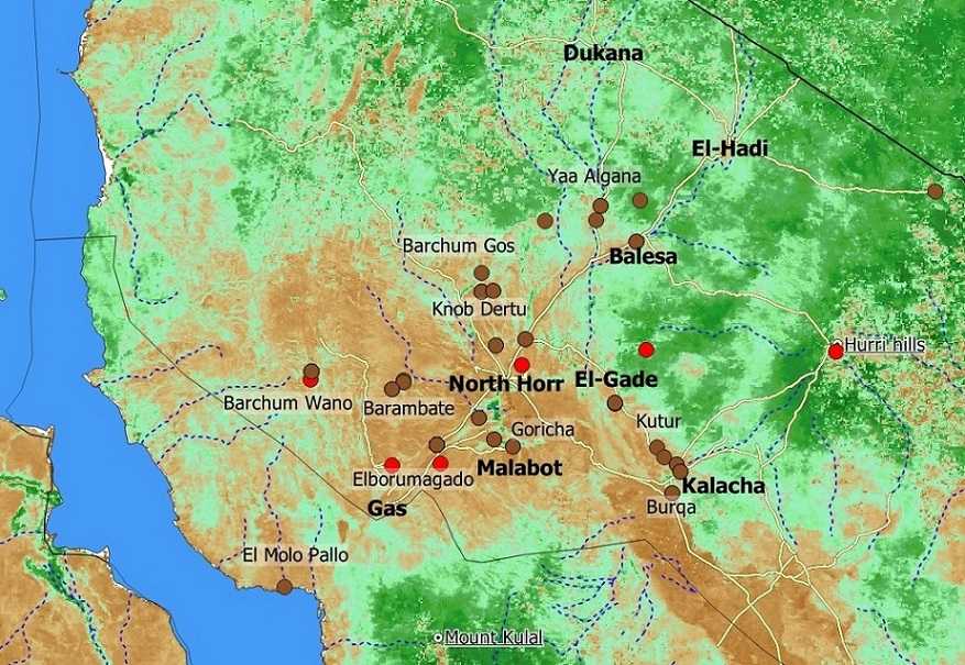
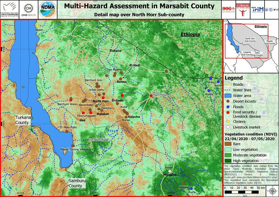
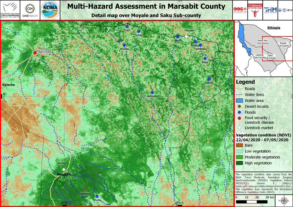
Produced maps, representing different types of hazards such as Flood, Deserts Locust, Livestock Diseases and Food Security, have been integrated into the Multi Hazard Assessment Report and the Multi Hazard Assessment Findings Presentation of the Marsabit County, for May 2020.
Geospatial data and technologies such as remote sensing or digital mapping are key tools to immediately visualise location, type and extent of hazards therefore significantly supporting risk assessment and response planning.
Desert Locust Assessment over North Horr Sub-County
Flood Assessment over Moyale and Saku Sub-County
Just so you know, this website uses cookies. What are cookies?

