Community-Based Observation Networks

To reduce the negative impact of weather-related events and enhance the wellbeing of people, animals and the environment
To reduce the negative impact of weather-related events and enhance the wellbeing of people, animals and the environment, we empower local communities to observe, measure, record and use relevant data for disaster risk reduction and agro-pastoral planning. In the last years, we have developed our approach which combines the 3Map Mobile App, 3Map web-application, the capacity building, the installation of manual weather stations and a community dialogues methodology.
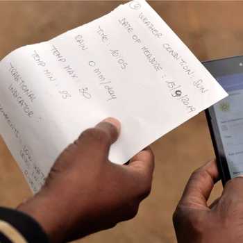
We support local actors to establish new simple manual weather stations where not available; we train community observers to measure daily and record on a smartphone weather-related data; we facilitate participatory discussions to analyse and interpret weather information and connect it to other observations about nature and their consequences, enhancing the local capacity to make informed decisions. We value local cultures and traditional knowledge and support their integration with science and technology.
“The scientific knowledge has really complemented the traditional knowledge by bridging the gap that has existed with traditional knowledge on weather and climate...the information sharing has been very easy because of Whatsapp, 3Map and Telegram platforms” (Guyo Gonjoba, Community Weather Observer, Gas, Kenya)
To maximise our impact, we work with a variety of partners: local and international institutions, Civil Society Organisations and research institutes.