One Health for HEAL
“In view of the growing climate- and weather-related challenges facing humanity... surface-based observations should be treated as a critical public good”
Daniel Kull, Senior Disaster Risk Management Specialist, World Bank
What make this project so unique?
The human approach through community-based observations.
The One Health for Heal Project, https://www.oh4heal.org applies a One Health (OH) approach to enhance the well-being and resilience of vulnerable communities in pastoralist and agro-pastoralist areas of Ethiopia, Somalia and Kenya. In the framework of the Heal Project, TriM is the technical collaborating partner responsible for the implementation of a network of community-based observatories to:
- Observe
- Measure
- Record
- Report
- Use relevant data to reduce the negative impacts of weather-related events and enhance the wellbeing of people, animals and the environment
What makes this project so unique is that TriM works with a human-centred approach. The community-based observation network is not only a technology solution, but also a platform where the people are at the core of everything. Moreover, TriM’s support is aligned with the One Health concept as it analyses the interaction of the environmental variables with the human and animal health ones.
How do we translate data into meaning?
Scientific evidence thanks to weather stations & 3Map system.
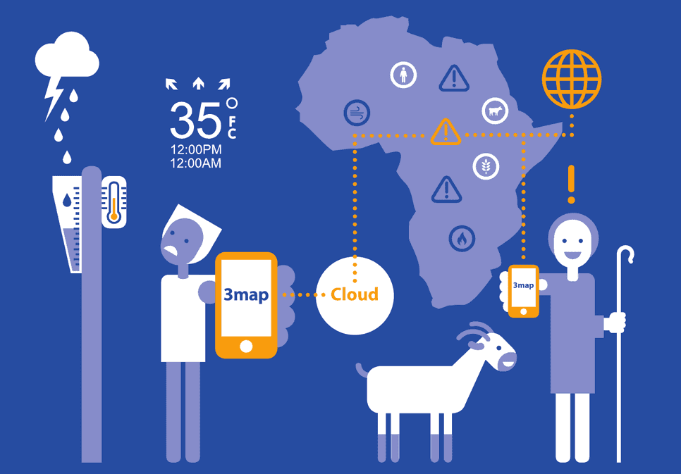
Thanks to the installation of 15 manual weather stations and the use of the 3Map system, pastoralists living in Isiolo and North Horr Sub-Counties (Kenya) and Filtu Woreda (Ethiopia), will be able to:
- measure daily weather data at village level.
- record weather data together with geotagged information about diseases, availability of water or pasture and any other impacts to health or natural resources.
- analyse and reflect on data through a participatory approach.

|

|
The methodologies and tools have been developed and tested in the framework of several projects that TriM has conducted in collaboration with local and international NGOs, community-based organisations and local authorities in Kenya, Ethiopia, Zimbabwe and Niger.
How do we work with local communities?
Bridging the gap between traditional knowledge and technology platforms.
Participatory discussions will be periodically organized at the community level to reflect on recorded data, the information coming from local institutions and the one shared by traditional experts, so that actions will be planned to take into account official information, traditional knowledge and scientific evidence.
Moreover, the periodical interpretation of scientific information during community discussions increases the confidence of people in the possibility of using measured data or other weather information, such as weather forecasts or satellite images, to complement traditional predictions.

|

|
All the information produced at the community level will be recorded into a cloud database, made accessible online through user-friendly visualisations and sharable through instant messaging applications, becoming an important reference to support future decisions.
Why is it so important to get real-time data?
The power to trigger immediate response in case of need.
Weather, hazards and impacts data recorded in the framework of our projects demonstrate to be very valuable to detail and complement regional, national and global data-sets.
Automatic real-time reports about observed hazards and periodical decision support bulletins will be produced and shared with relevant people and institutions at different levels through Telegram or WhatsApp to immediately inform them about the current weather conditions, make comparisons with the climate baseline and identify potential risk scenarios.
The real-time messages about hazards and impacts are particularly important to trigger an immediate and collective response in case of need.

|

|
“The scientific knowledge has really complemented the traditional knowledge by bridging the gap that has existed with traditional knowledge on weather and climate... the information sharing has been very easy because of Whatsapp, 3Map and Telegram platforms”
Guyo Gonjoba, Community Weather Observer, Gas, Kenya
Ground Weather Stations installed in the HEAL Project
